 Cart(
Cart(

GO INTO THE WILD WITH A SATELLITE CONNECTION
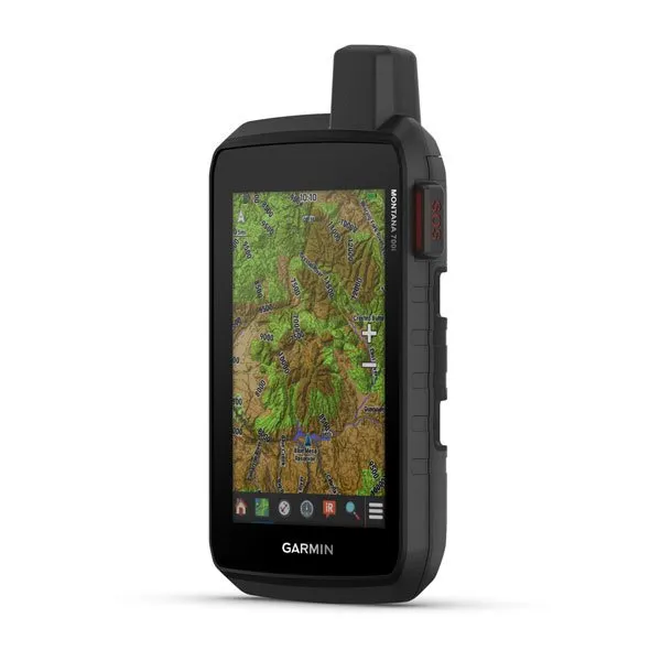
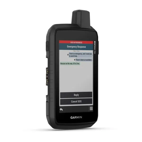
To keep adventurers in touch and on track, the Montana 700i handheld combines the flexibility of on- or off-road navigation with global messaging and interactive SOS via inReach satellite technology1.
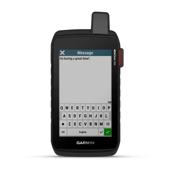
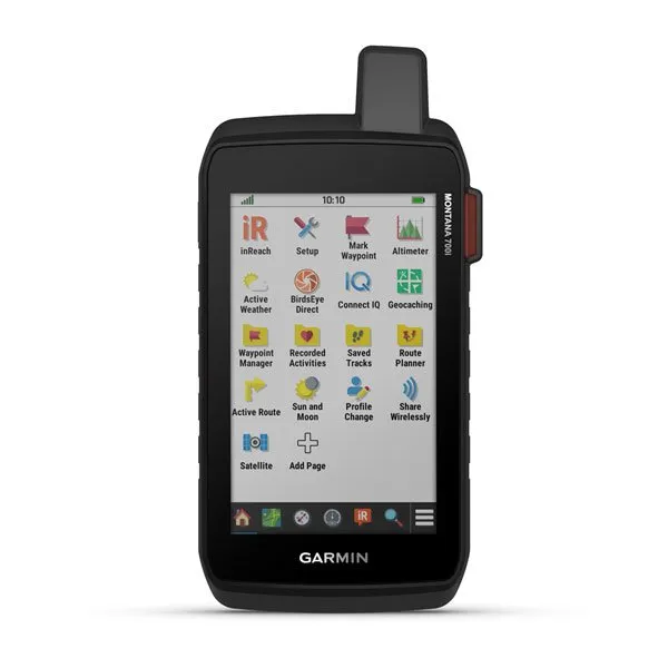
Big news. A full QWERTY keyboard lets you easily type messages.
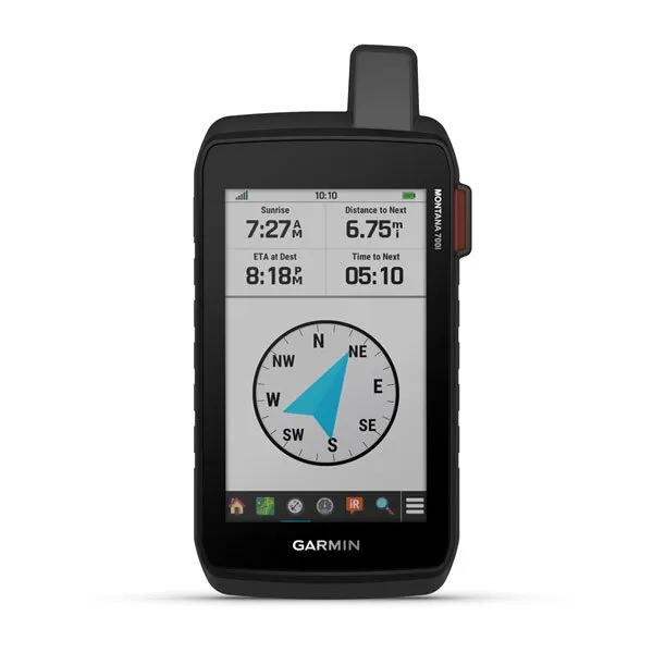
Wander wider and still stay in touch with inReach for messaging and 24/7 SOS.
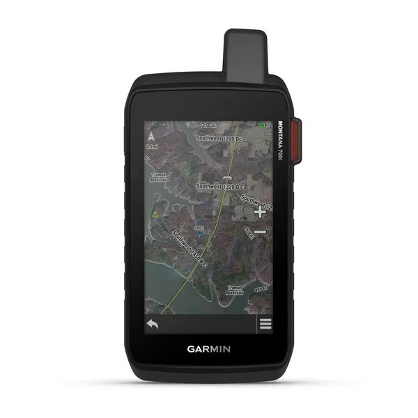
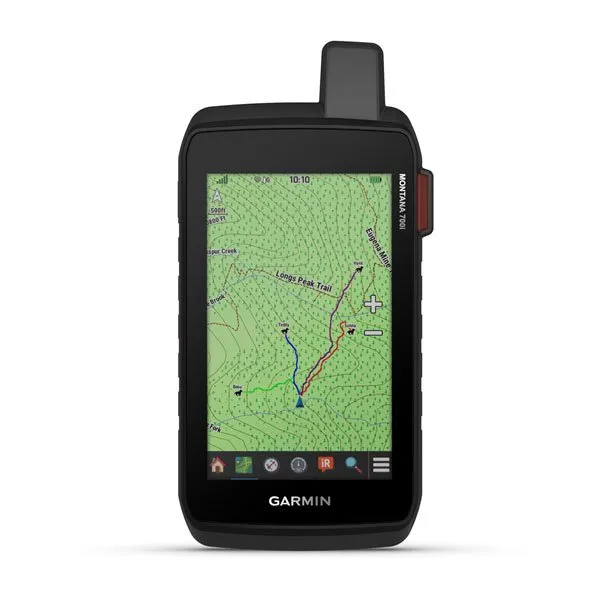
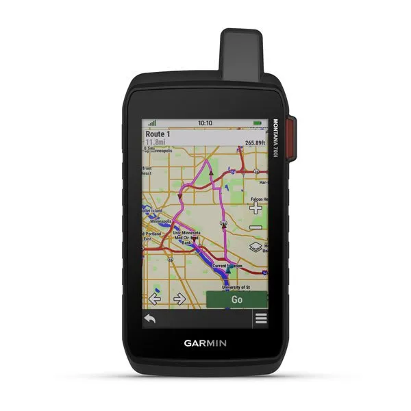
Routable topographic maps? Check. Now youre free to take it off-road or on.
Built like a tank. Meets MIL-STD 810 for thermal, shock, water and vibration.
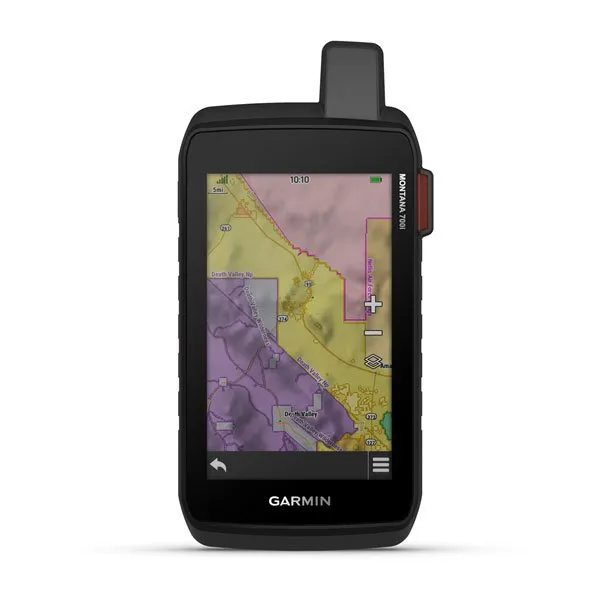
Get the clear perspective of BirdsEye Satellite Imagery right to your device.
Power your adventures with 18 hours of lithium-ion battery life in GPS mode.
General | |
| PHYSICAL DIMENSIONS | 3.6" x 7.2" x 1.3" (9.19 x 18.30 x 3.27 cm) |
|---|---|
| TOUCHSCREEN | yes |
| DISPLAY SIZE | 2.55"W x 4.25"H (6.48 x 10.80 cm); 5" diag (12.70 cm) |
| DISPLAY RESOLUTION | 480 x 800 pixels |
| DISPLAY TYPE | WVGA transflective, dual orientation |
| WEIGHT | 14.5 oz (410 g) with included lithium-ion battery pack |
| BATTERY TYPE | rechargeable lithium-ion (included) |
| BATTERY LIFE | GPS Mode: up to 18 hours |
| IPX7 | |
| MIL-STD-810 | yes (thermal, shock, water, vibe) |
| HIGH-SENSITIVITY RECEIVER | |
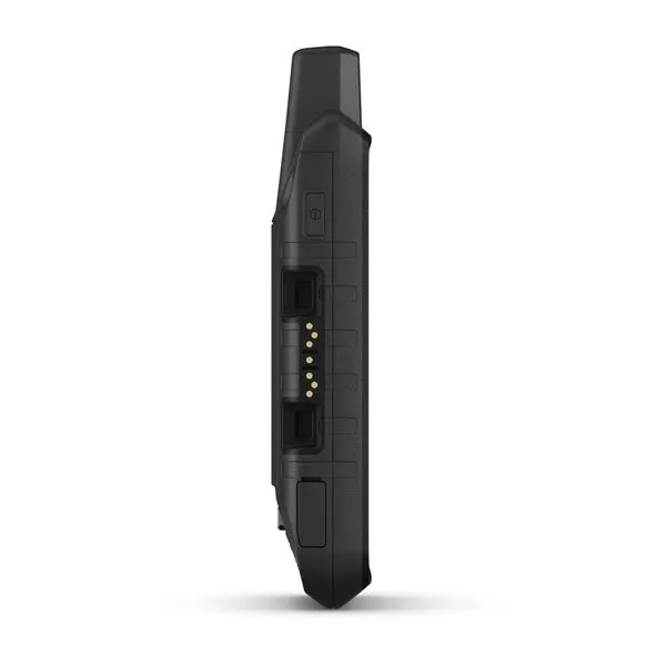
| INTERFACE | high speed micro USB and NMEA 0183 compatible |
| MEMORY/HISTORY | 16 GB (user space varies based on included mapping) |
Maps & Memory | |
| PRELOADED MAPS | yes(TopoActive, by Region; City Navigator Maps, North America; Federal Public Lands Map, USonly) |
|---|---|
| ABILITY TO ADD MAPS | yes |
| BASEMAP | yes |
| AUTOMATIC ROUTING (TURN BY TURN ROUTING ON ROADS) FOR OUTDOOR ACTIVITIES | yes |
| AUTOMATIC ROUTING (TURN BY TURN ROUTING ON ROADS) FOR MOTORIZED VEHICLES | yes |
| MAP SEGMENTS | 15000 |
| BIRDSEYE | yes (direct to device) |
| INCLUDES DETAILED HYDROGRAPHIC FEATURES (COASTLINES, LAKE/RIVER SHORELINES, WETLANDS AND PERENNIAL AND SEASONAL STREAMS) | yes |
| INCLUDES SEARCHABLE POINTS OF INTERESTS (PARKS, CAMPGROUNDS, SCENIC LOOKOUTS AND PICNIC SITES) | yes |
| DISPLAYS NATIONAL, STATE AND LOCAL PARKS, FORESTS, AND WILDERNESS AREAS | yes |
| EXTERNAL MEMORY STORAGE | yes (32 GB max microSD card) |
| WAYPOINTS/FAVORITES/LOCATIONS | 10000 |
| TRACKS | 250 |
| TRACK LOG | 20000 points, 250 saved gpx tracks, 300 saved fit activities |
| ROUTES | 250, 250 points per route; 50 points auto routing |
| RINEX LOGGING | yes |
Sensors | |
| GPS | yes |
|---|---|
| GALILEO | yes |
| BAROMETRIC ALTIMETER | yes |
| COMPASS | Yes (tilt-compensated 3-axis) |
| GPS COMPASS (WHILE MOVING) | yes |
Daily Smart Features | |
| CONNECT IQ (DOWNLOADABLE WATCH FACES, DATA FIELDS, WIDGETS AND APPS) | yes |
|---|---|
| SMART NOTIFICATIONS ON HANDHELD | yes |
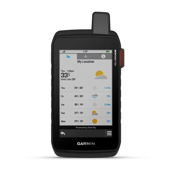
| WEATHER | yes |
| VIRB REMOTE | yes |
| PAIRS WITH GARMIN CONNECT MOBILE | yes |
| ACTIVE WEATHER | yes |
Safety and Tracking Features | |
| LIVETRACK | yes |
|---|---|
Outdoor Recreation | |
| POINT-TO-POINT NAVIGATION | yes |
|---|---|
| COMPATIBLE WITH BASECAMP | yes |
| AREA CALCULATION | yes |
| HUNT/FISH CALENDAR | yes |
| SUN AND MOON INFORMATION | yes |
| XERO LOCATIONS | yes |
| yes (Geocache Live) | |
| yes (500 custom map tiles) | |
| PICTURE VIEWER | yes |
| LED BEACON FLASHLIGHT | yes |
inReach Features | |
| INTERACTIVE SOS | yes |
|---|---|
| SEND AND RECEIVE TEXT MESSAGES TO SMS AND EMAIL | yes |
| SEND AND RECEIVE TEXT MESSAGES TO OTHER INREACH DEVICE | yes |
| EXCHANGE LOCATIONS WITH OTHER INREACH DEVICE | yes |
| MAPSHARE COMPATIBLE WITH TRACKING | yes |
| VIRTUAL KEYBOARD FOR CUSTOM MESSAGING | yes |
| SEND WAYPOINTS TO MAPSHARE DURING TRIP | yes |
| SEND ROUTE SELECTION TO MAPSHARE DURING TRIP | yes |
| INREACH REMOTE COMPATIBLE | yes |
Outdoor Applications | |
| COMPATIBLE WITH GARMIN EXPLORE APP | yes |
|---|---|
| GARMIN EXPLORE WEBSITE COMPATIBLE | yes |
| DOG TRACKING | yes (when paired to compatible dog track system) |
Connections | |
| WIRELESS CONNECTIVITY | yes (Wi-Fi, BLUETOOTH, ANT ) |
|---|---|


 Smai")


